The Field Guide

Find a place to camp on
public land.

Free campgrounds, dispersed sites, and the roads to get to them, in one offline-capable app.

Download the app
More US campsites than iOverlander — see the comparison
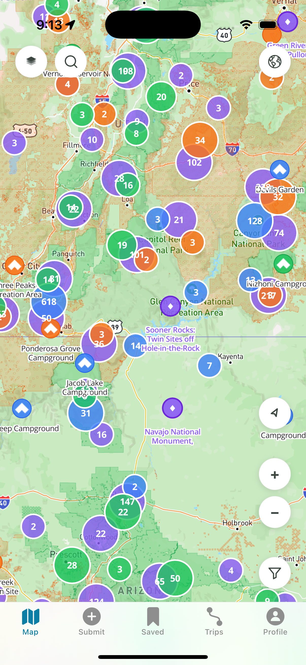
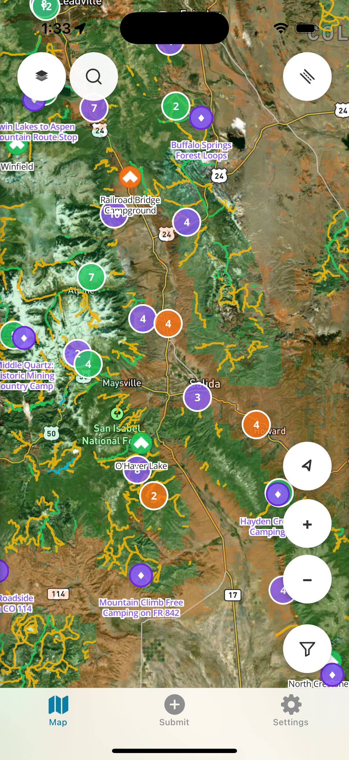
Dispersed map view showing campgrounds and dispersed camping roads
Coverage Last refresh · 2026-05-29
Total campgrounds
36,700+
USFS · BLM · NPS · State
Dispersed sites
13,800+
Mapped + community-curated
Free to camp
26,800+
No fee, no reservation
Miles of camping roads
78,800+
Derived from USFS Motor Vehicle Use Maps
Sources · USFS, BLM, NPS, state agencies, community submissions vs iOverlander →
Inside the app v1.2

Built for the rig you roll with.

Vans, jeeps, RVs, overland trucks, weekend tents. Dispersed is a field-reference tool for finding a spot to spend the night on public land — and getting there.

Free · New in 1.2

14,000+ Hidden Gems, now free for everyone.

Community-curated dispersed campsites you won't find on any other map. Unlocked in v1.2 because public land belongs to everyone, and the people who camp on it should be able to find it.

Explore the map
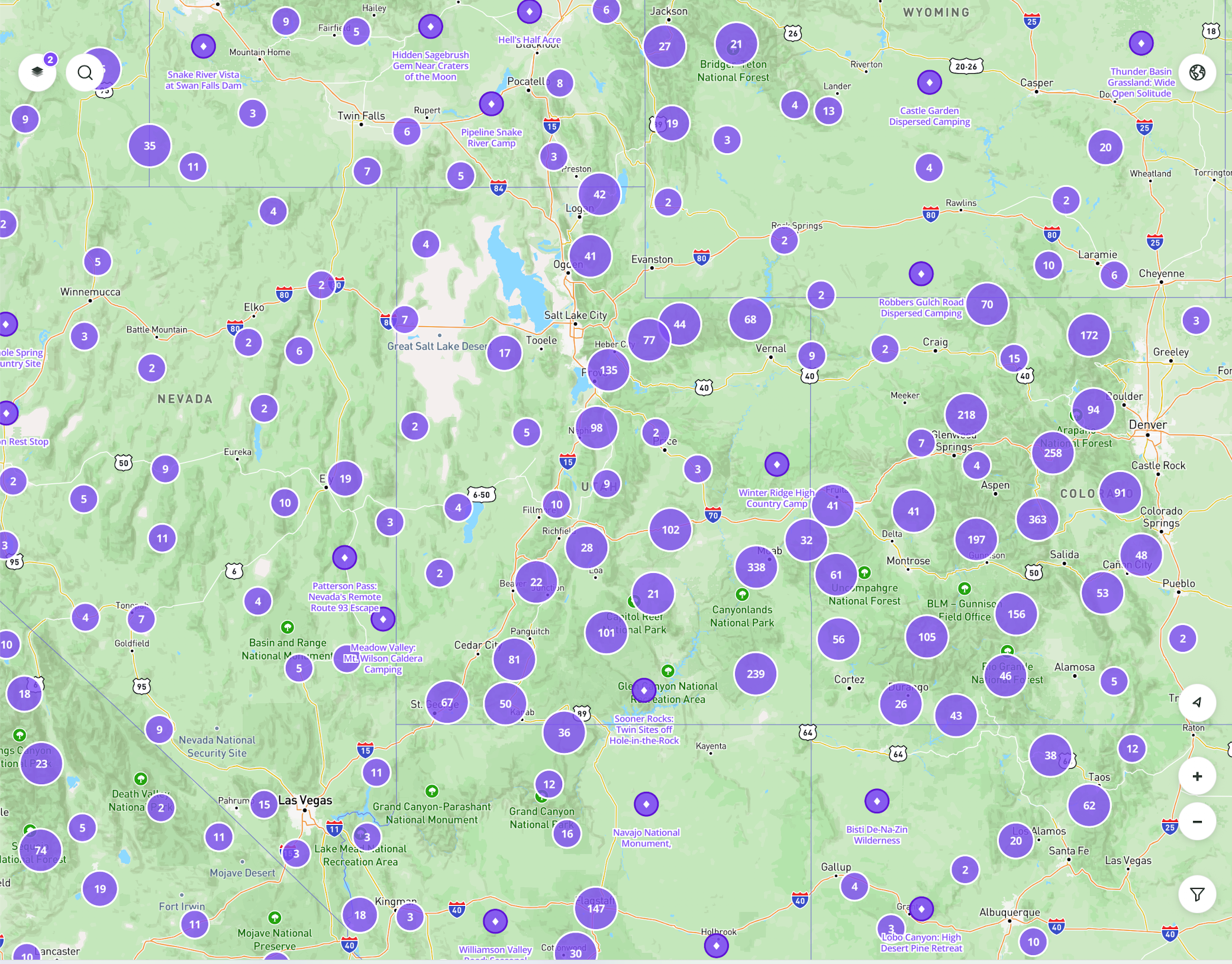
Map view showing thousands of community-curated hidden gem campsites
14,000 hidden gems · live
Premium

Dispersed Camping Roads

National Forest roads designated for dispersed camping. The actual roads you're allowed to camp on, derived from USFS Motor Vehicle Use Maps.

Premium

Trip Planner

Build multi-stop trips with routing tuned for public-land camping. Save them for the road. Vibe-based stop suggestions: Recover · Roll · Explore.

Premium

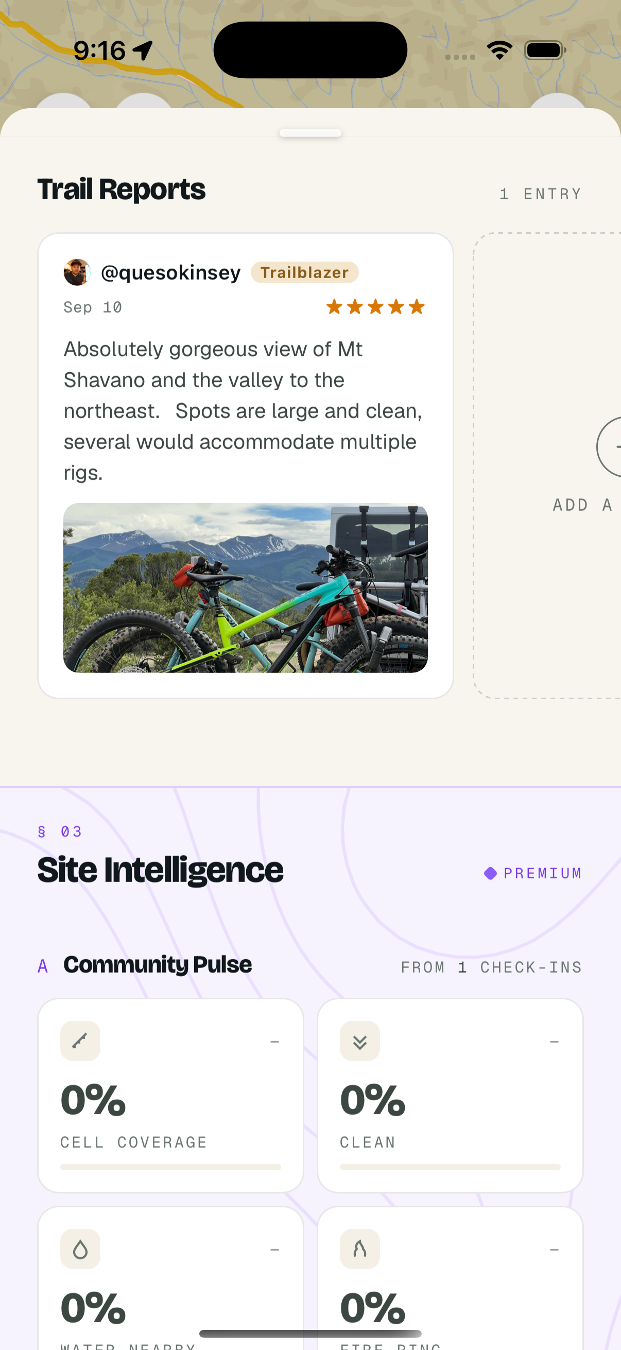
Site Intelligence

Weather forecasts, regulatory monitoring, and Community Pulse — cell coverage, crowding, site condition signals aggregated from every check-in.

Premium

Offline Maps

Download tiles + campsite data before you go. No cell service is the rule, not the exception, where you're headed.

Free

Community Check-ins

Cell coverage, vehicle access, crowding, site conditions, and photos — submitted by Dispersed users from the field.

Free

Public Land Boundaries

USFS, BLM, NPS, and state-trust land boundaries layered on the same map. See exactly which agency administers the ground beneath the pin.

Built for
Van life & full-time RV Overlanders & 4×4 adventurers Boondockers & dry campers Weekend warriors on a budget Hunters & anglers on public land
Public campsite data is free forever

One map. Two tiers. No paywall on the basics.

36,700+ campgrounds on US public land — free, forever. Upgrade for the dispersed camping roads, offline maps, trip planner, and site intelligence.

Free Forever

$0
Always
36,700+ Campgrounds on US public land
26,800+ are free to camp at. 13,800+ are dispersed sites.
14,000+ Hidden Gems
Community-curated dispersed campsites — free in v1.2.
Community Check-ins
Real reports from real campers — cell, access, crowding, conditions.
Public Land Boundary Maps
USFS, BLM, NPS, and state lands on the same map.
Save favorites · Real-time GPS
Bookmark sites and track your position while exploring.
No account required to browse. Email sign-up to save.

Premium

7 days free
then $29.99/yr
Dispersed Camping Roads
USFS-designated roads where dispersed camping is allowed. Derived from Motor Vehicle Use Maps.
Offline Map Downloads
Tiles + campsite data downloaded for use without cell service.
Trip Planner
Multi-stop trips with routing tuned for public-land camping.
Unlimited Favorites Lists
Organize campsites into multiple lists for different trips and regions.
Site Intelligence
Weather, regulatory monitoring, and Community Pulse aggregates.
Other apps: $60–100/yr · Dispersed: $29.99/yr
In the field iOS · Android · v1.2

Every feature, designed for the field.

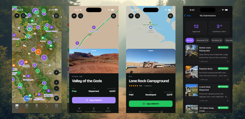
A look at the map, hidden gems, check-in flow, and contributor submissions.

A
Map · 36,700+ sites
B
Hidden Gem detail
C
Site sheet · Check-in
D
My submissions
Field reports From the community · live

Recent check-ins from the community.

Live check-ins from Dispersed users — pulled directly from the app. Cell coverage, vehicle access, conditions, photos.

Hidden Gem

Chatt-Oconee Site

"Internet connection good, I know that's not a priority but it's raining and I forgot my rain jacket.( 3 to 5 bars T-Mobile). Roading coming from Helen was a little bumpy but if you have a truck or something with higher clearance than 5 to …"
@Notsnoopie ★★★★★ May 26
Hidden Gem

Pine Island

"Beautiful spot in the pine trees 30 miles from the North Rim of the Grand Canyon. Off of well graded road, campsites are way dispersed, over 900 ft apart. Arizona Trail was 10ft behind campsite. "
@fbenefiel ★★★★★ May 18
Hidden Gem

Stewart's Creek

"Located at the Upper parking of Stewart's Creek Wildlife Management Area is a lot big enough for 10 to 15 Vanlifers, Roof Top Tenters, and car campers. This is a Virginia DNR spot, camping is free, but must obtain a permit online. There…"
@Mothman_Overland ★★★★★ May 3
Get the app

Ready when you are.

iOS and Android. Free with optional Premium. Built by people who use it every weekend on US public land.

Premium includes a 7-day free trial. Cancel anytime, even on day 1.
Dispersed map view
Map
Hidden gem detail
Hidden Gem
Download Dispersed 7-day free trial