Boondocking & Overlanding
Campgrounds + dispersed camping roads in one app. Find free camping on USFS, BLM, National Park, and state public land. Weather, check-ins, saved lists, offline maps. Try free for 7 days.
A closer look at what's inside.
Six things Dispersed is built to do well — from finding the campsite to getting there offline.
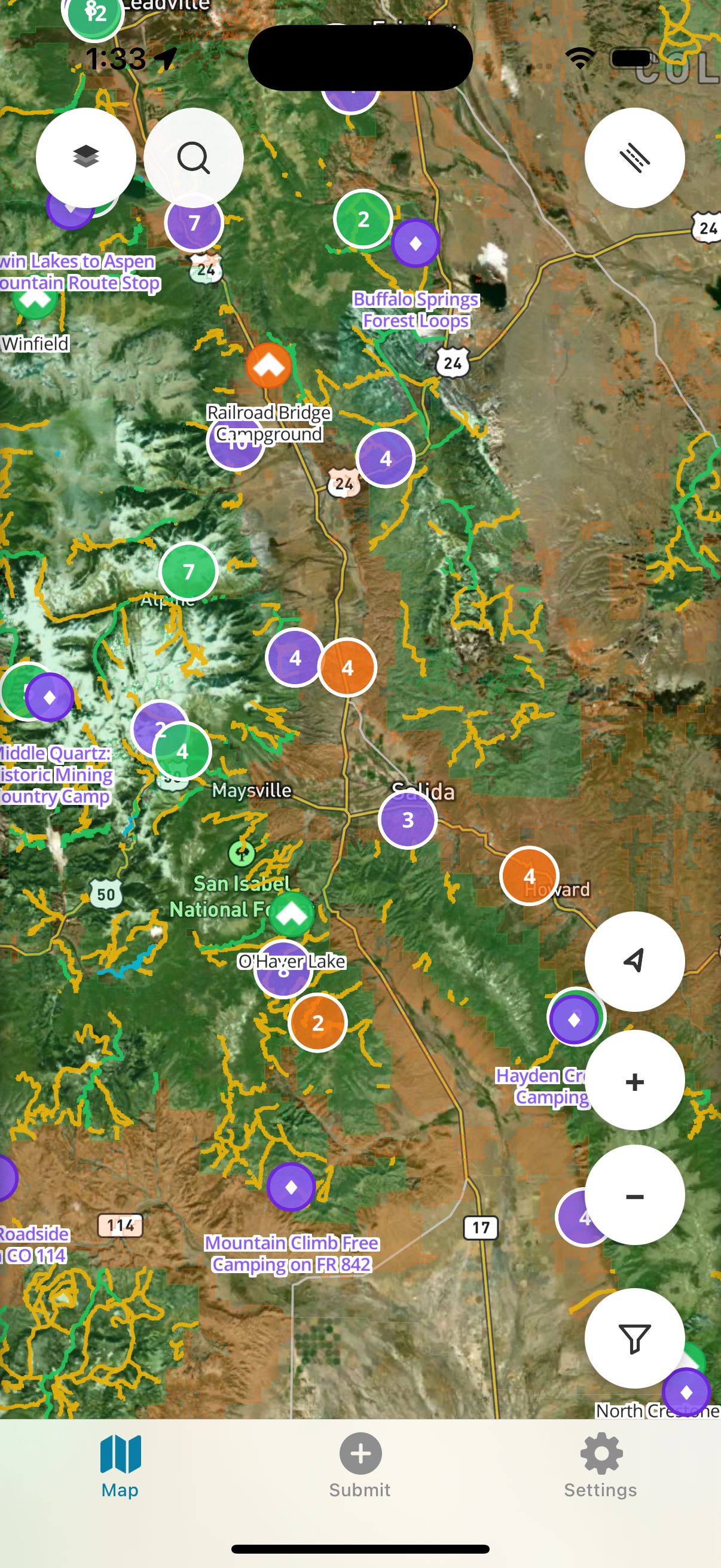
Every campsite within reach.
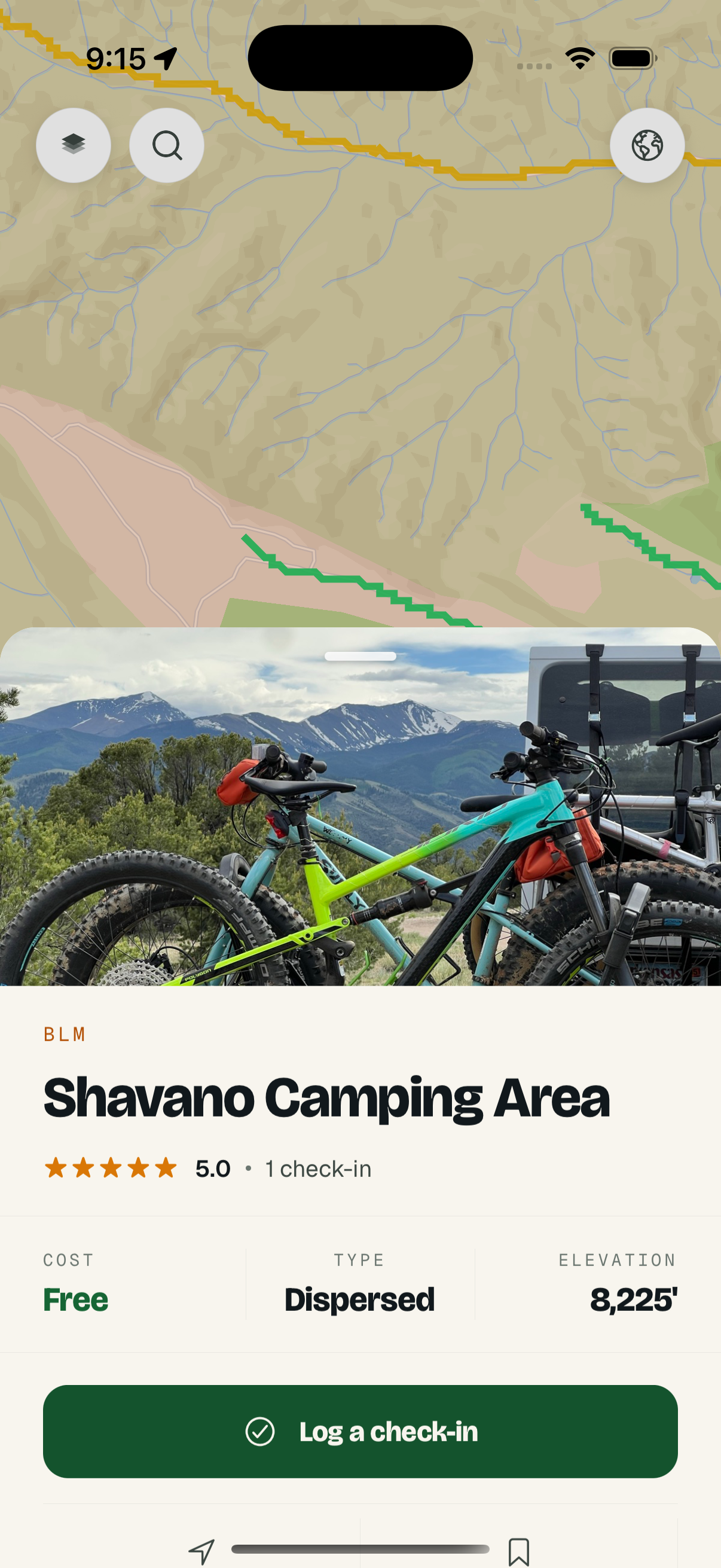
USFS, BLM, NPS, and 19,100+ community-curated hidden gems — all on one map. Tap any pin for cost, type, elevation, weather, and check-ins.
FREE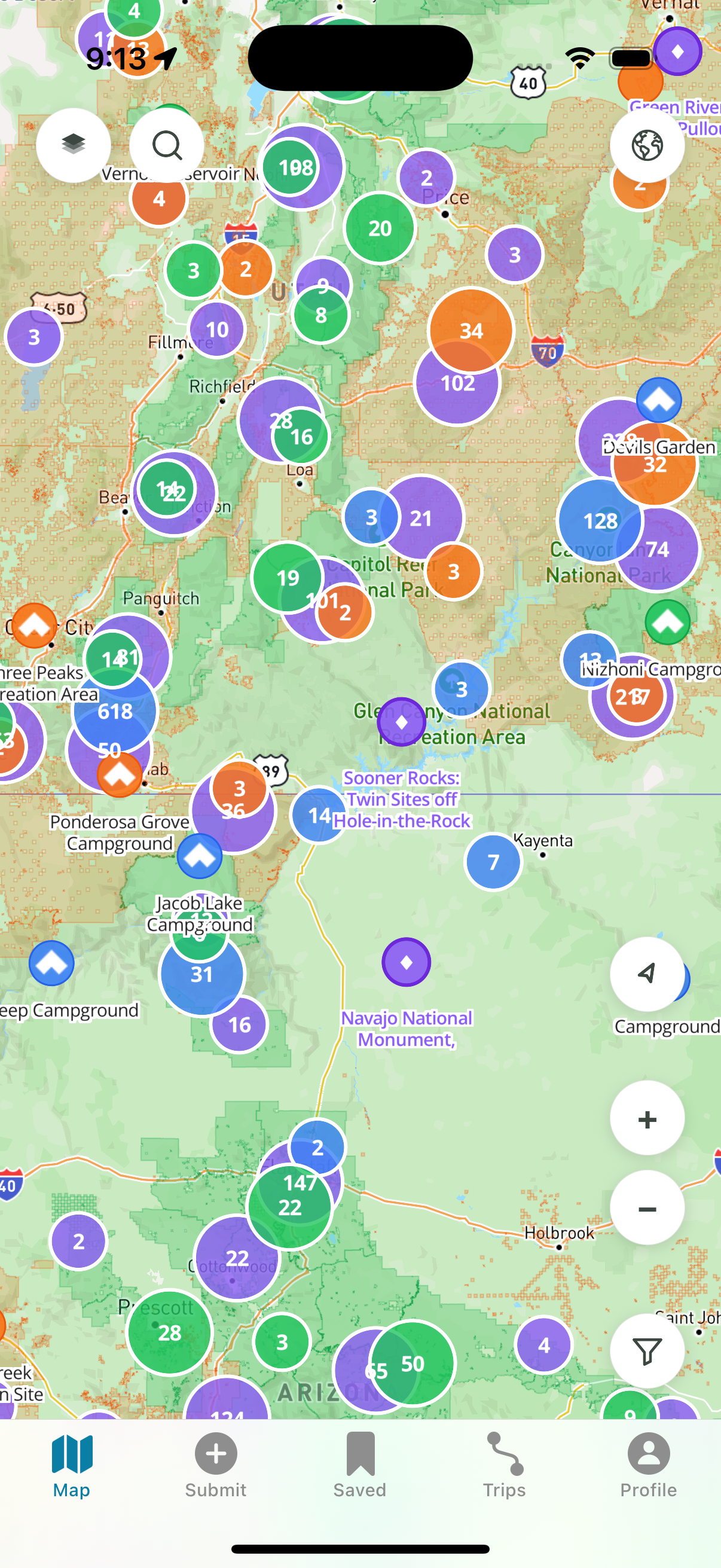
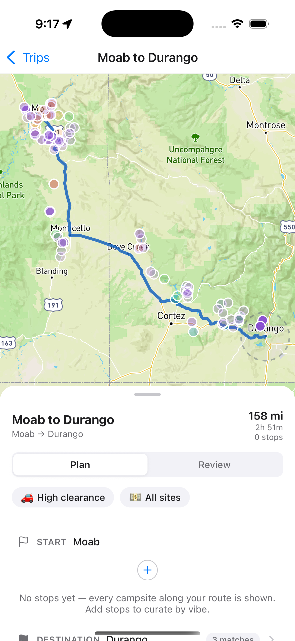
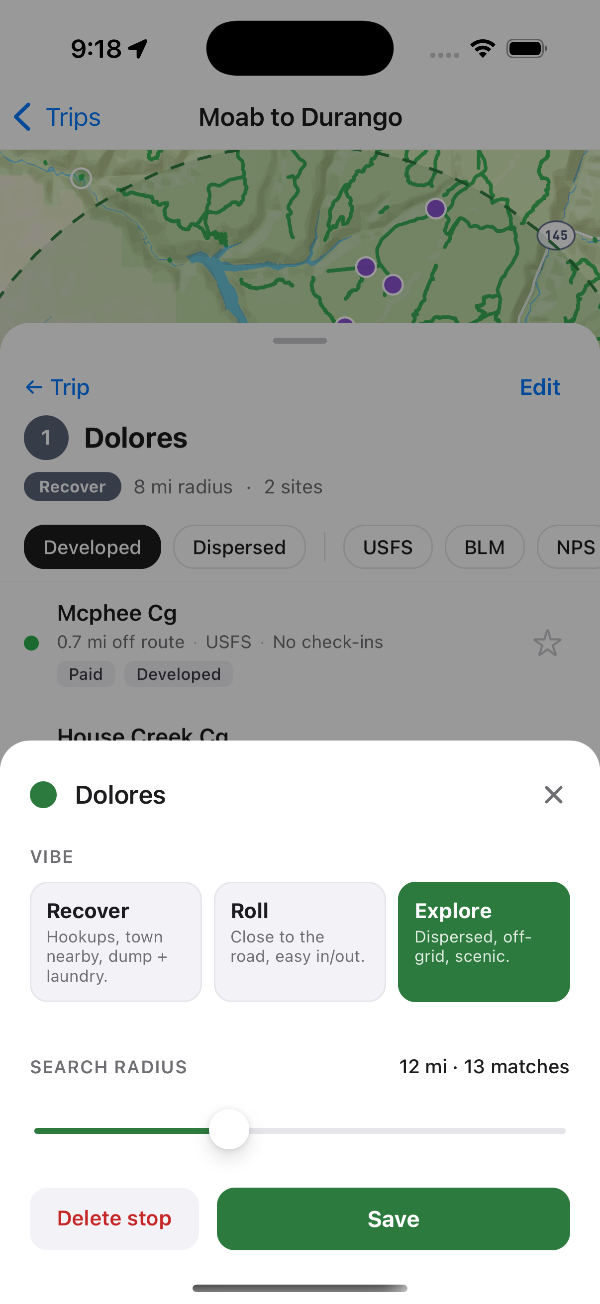
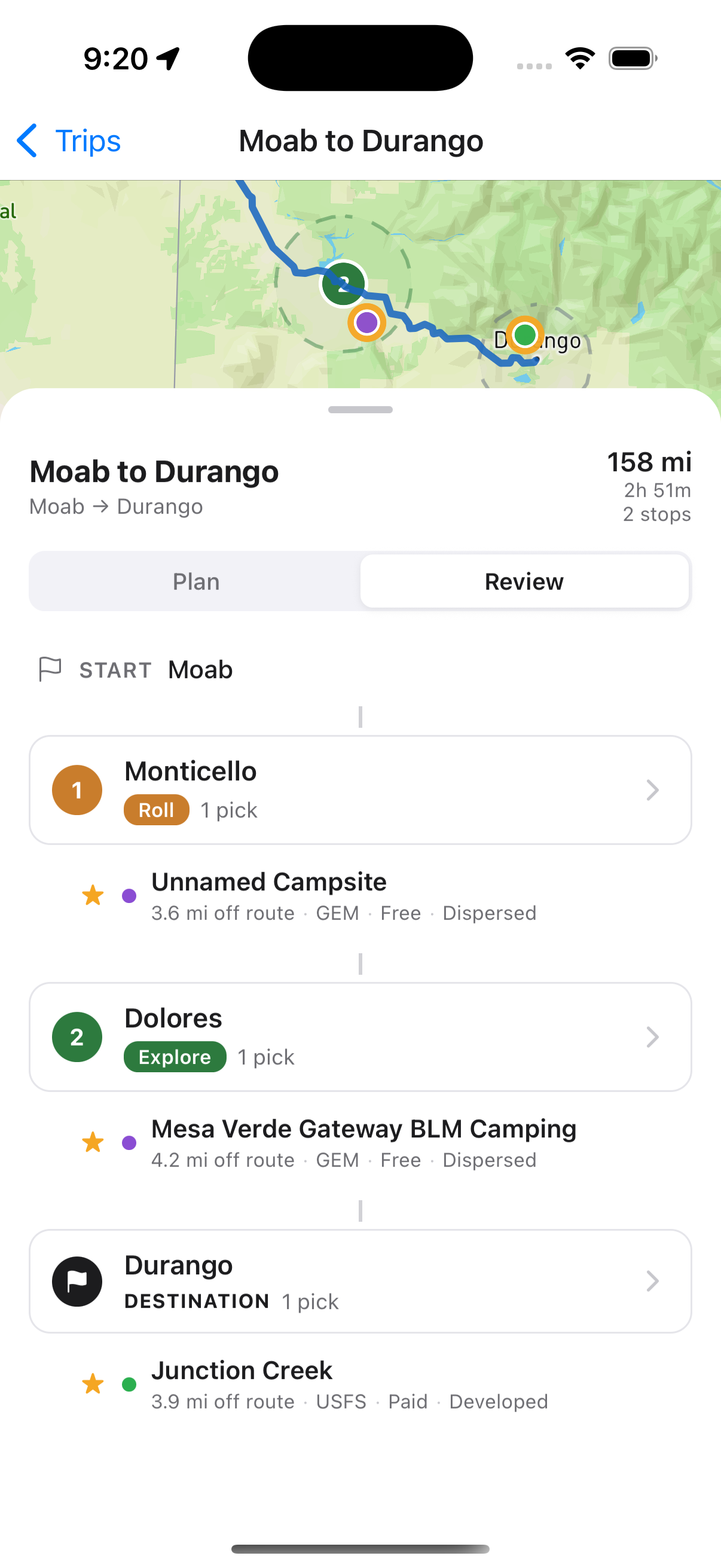
Multi-stop trips, tuned for camping.
Build a route, pick a vibe for each night (recover, roll, explore), and let Dispersed surface every campsite within range. Save trips to your account and revisit anytime.
PREMIUM · NEW19,100+ spots you won't find anywhere else.
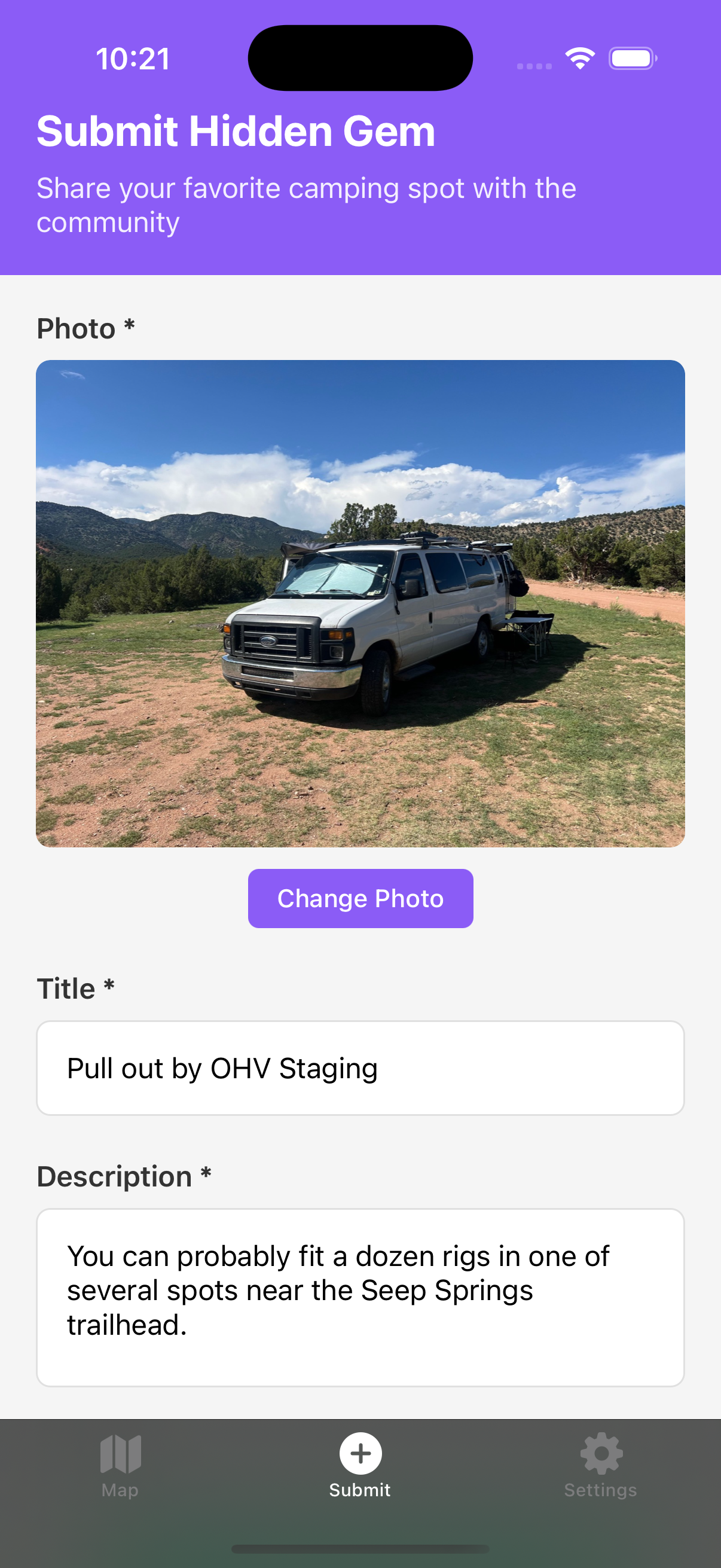
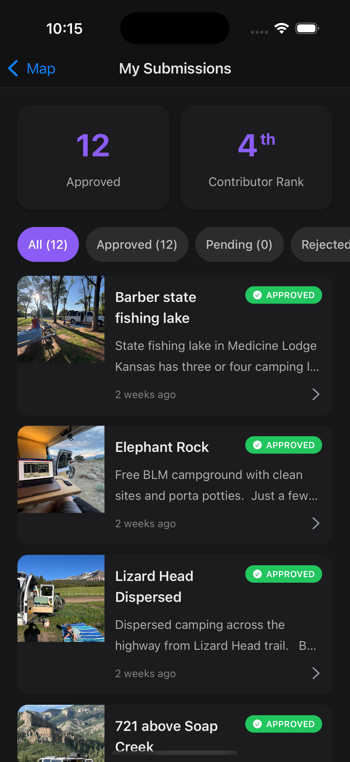
Community-curated dispersed campsites — pulled together from real campers, not scraped lists. Submit your own and earn badges.
FREE — NEW IN 1.2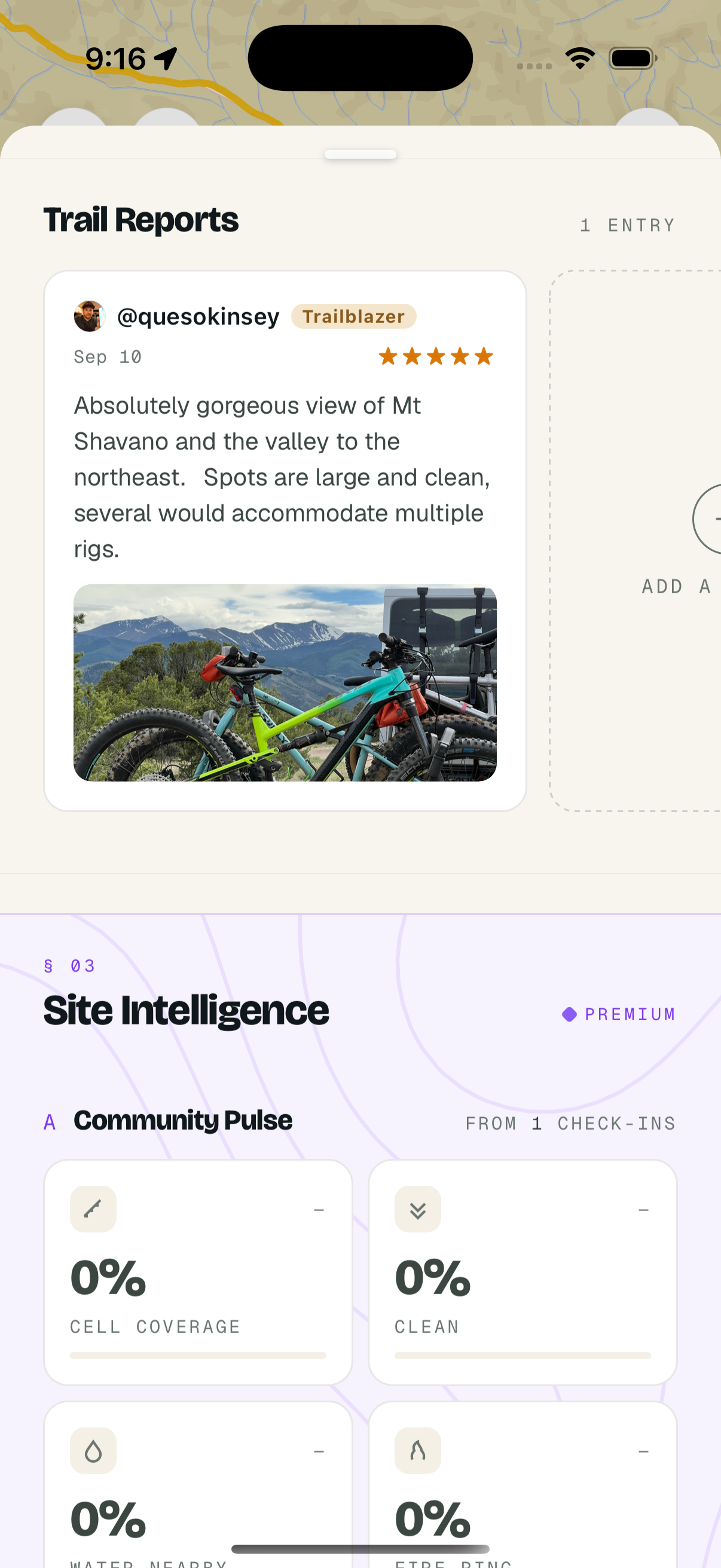
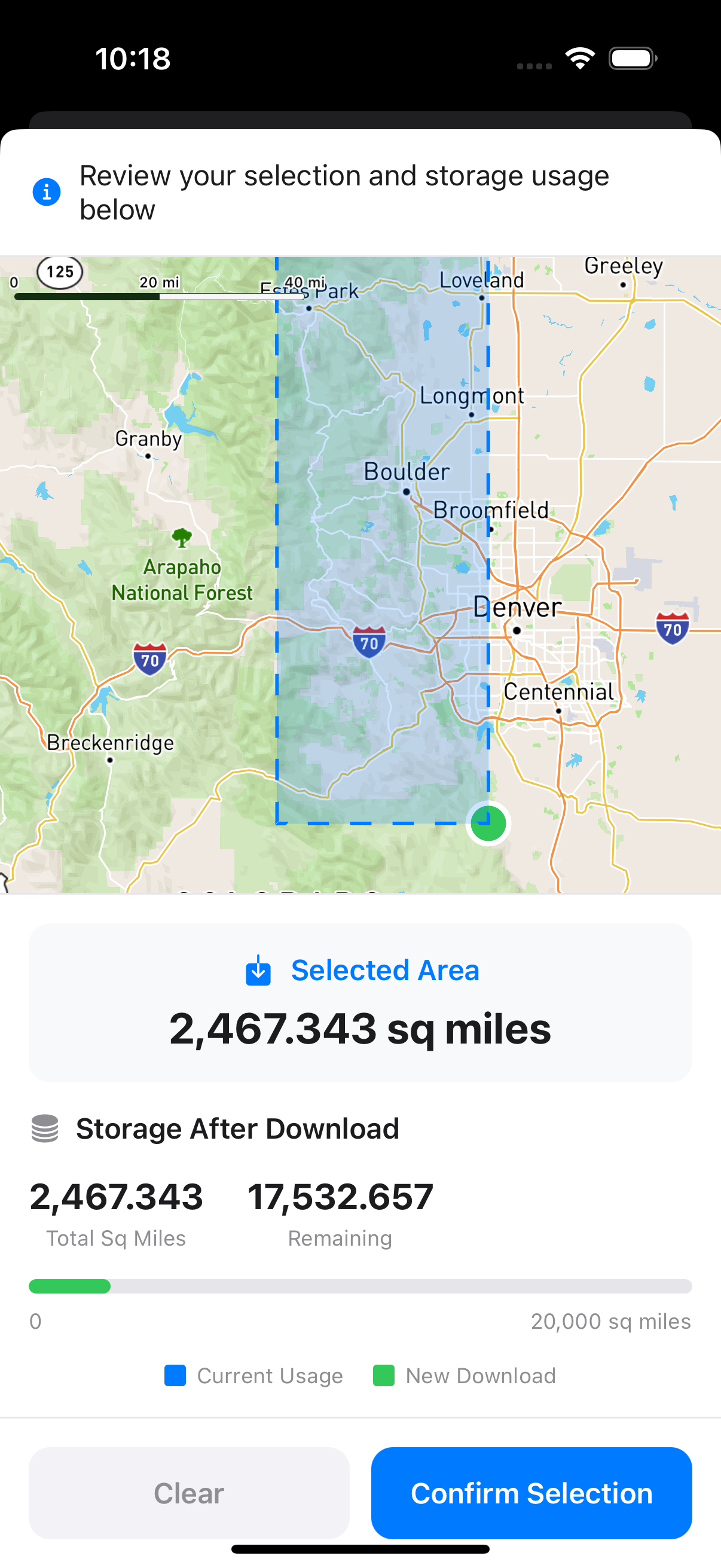
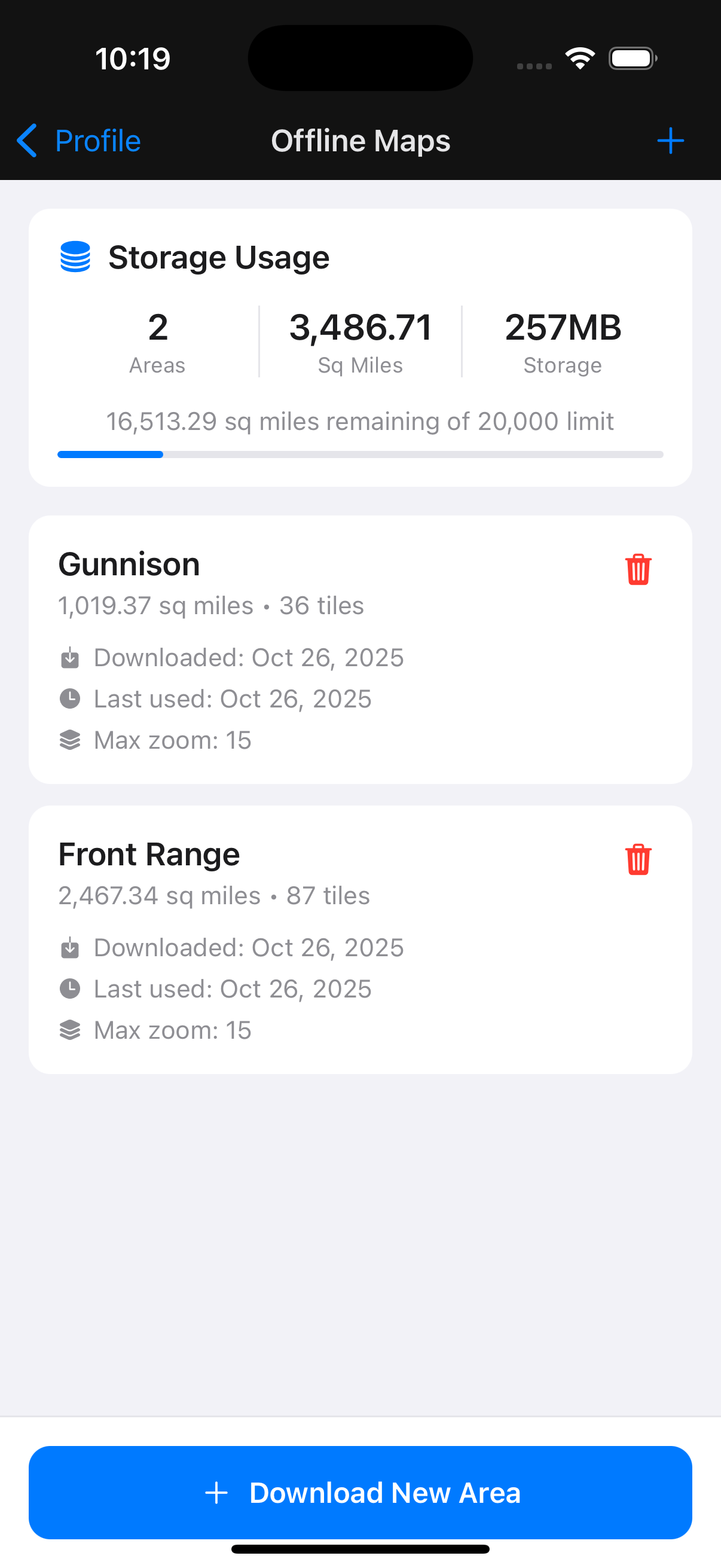
Camp without service.
Download maps, campsites, and dispersed-camping roads to your phone before you go. No bars? Doesn't matter — you've already got it.
PREMIUMCheck in. Help the next camper.
Log a quick check-in: cell signal, water, fire ring, how crowded, how to get there. Track your contributions and climb the leaderboard.
FREE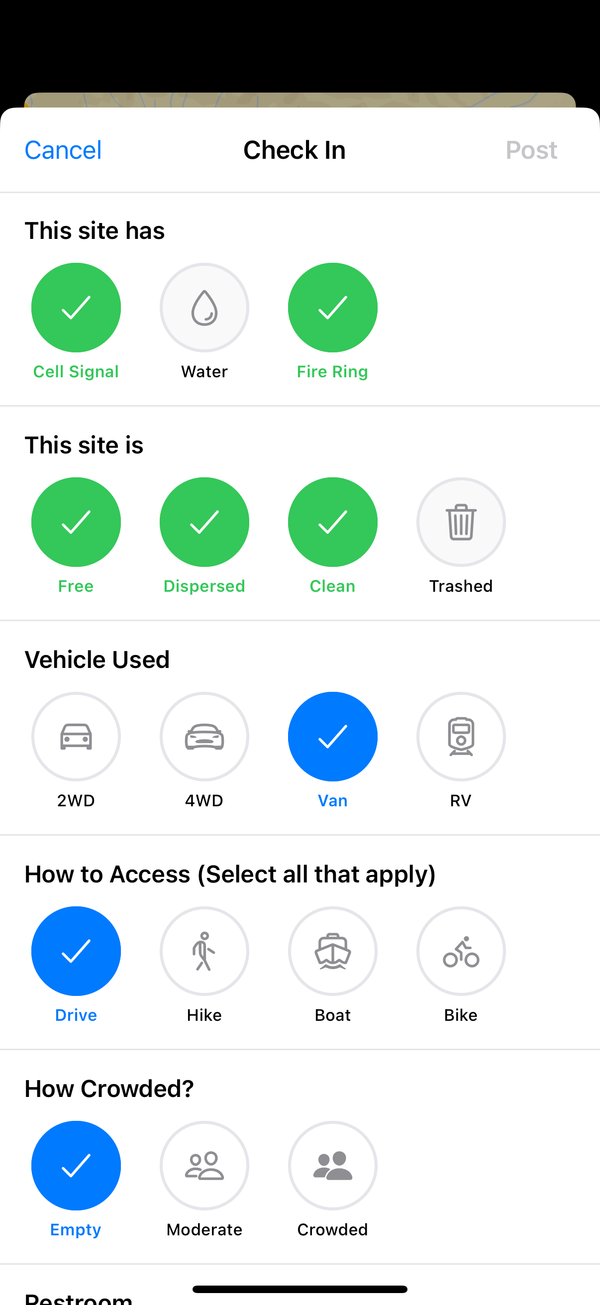
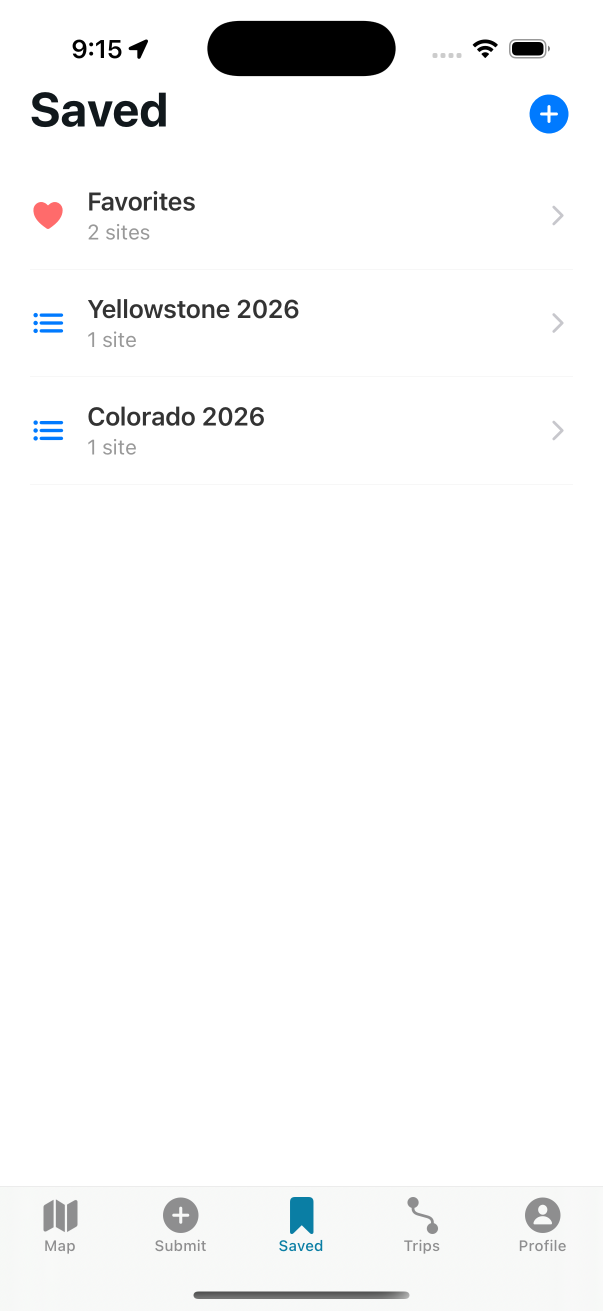
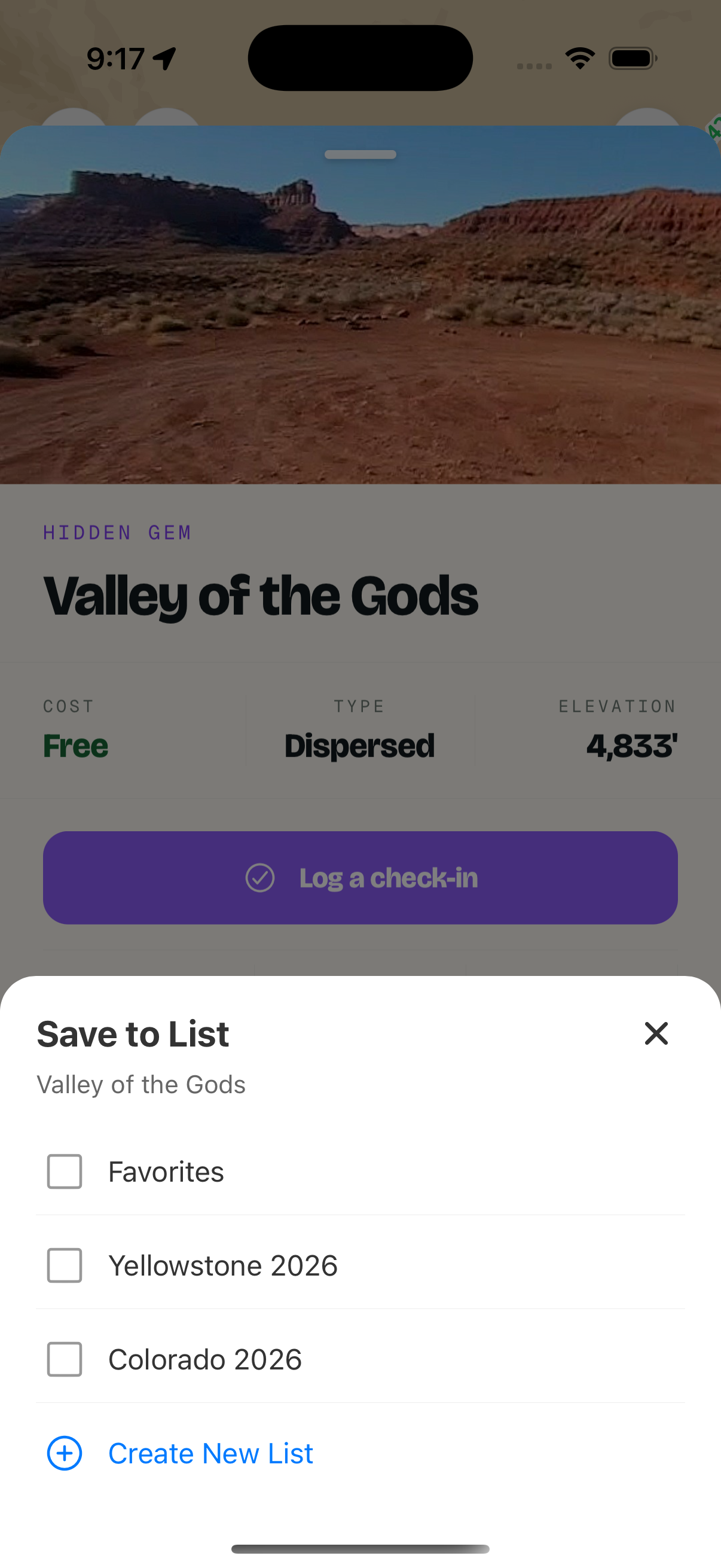
A list for every trip and season.
Save campsites into as many lists as you want — "Spring desert", "Quick weekend", "Friends only". Pull them up later, even offline.
PREMIUMCampgrounds + Dispersed Roads
41,700+ campgrounds on US public land, free forever. Upgrade for MVUM dispersed camping roads, offline maps, trip planner, and site intelligence.
-
41,700+ Campgrounds on US Public Land30,500+ are free to camp at. 14,800+ are dispersed sites.
-
19,100+ Hidden GemsCommunity-curated dispersed campsites you won’t find on any other map
-
Community Check-InsCell coverage, vehicle access, crowding levels, site conditions from real campers
-
Real-Time Location TrackingGPS tracking while you explore public lands
-
Save FavoritesBookmark campsites to your favorites list for quick access
-
Public Land Boundary MapsSee exactly where USFS, BLM, NPS, and state public lands are located
-
MVUM Dispersed Camping RoadsSee which National Forest roads are designated for dispersed camping — data derived from USFS Motor Vehicle Use Maps
-
Offline Map DownloadsDownload maps and campsite data for areas without cell service
-
Trip PlannerBuild and save multi-stop trips with routing tuned for public-land camping
-
Unlimited Favorites ListsOrganize campsites into multiple lists for different trips and regions
-
State Public Lands DataState forest, WMA, and trust-land boundaries layered on the same map
-
Site IntelligenceWeather forecasts, regulatory monitoring, and condition signals for every site
Stay in the Loop
Get updates on new features, data layer expansions, coverage updates, and news affecting camping on US public lands.
No spam. Unsubscribe anytime.
Start Exploring Today
Join thousands of adventurers discovering amazing campsites on public lands across America.